Monday, October 18, 2010

Pictures!

Today was another field day.  I helped out lab mate Jeff in collecting water samples in the Neuse River.  Jeff is investigating the natal origins of striped bass in the Neuse and Pamlico Rivers using otolith microchemistry.  Today, was awesome!  Nothing went wrong (which is unusual for field work that I am involved in), the work went quickly, the water was calm, and the weather was beautiful. 

The only thing really interesting or different about today was that it was the first time that the responsibility of captaining the boat was put solely on me.  Throughout the summer I have been conducting my research in conjunction with a commercial fishermen, so I haven't needed to drive the boat myself.  I am by no means afraid or inexperienced when it comes to driving boats.  I have been driving boats for most of my life, but mostly on small lakes and it's a whole different experience driving boats in large rivers/estuaries.  Also, I find that recreational boating is way different than boating for work, when you have a specific goal, like completing research, it can be a bit stressful.  Fortunately everything went swimmingly so I will just present a short pictorial narrative of the days events.

As stated previously the day was beautiful
We launched in the Neuse River and headed upstream.  I haven't really spent anytime on the Neuse River and didn't realize how narrow and winding it could be in some places.  It kind of reminded me of the Roanoke River in some places.  Our first site was around the route 43 bridge
And we started collecting water
Using this sophisticated piece of machinery
It was a really nice location, it was nice to see some trees with leaves starting to change
From there we headed downstream to the hwy 70 bridge
This is where we had the only minor snag of the trip.  We had to wait about a half hour to go under a railroad bridge because a train was crossing at a snails pace. We took water samples and water quality data
We then headed to our next location.  The world famous Dawson's Creek
Yes this is where the TV show Dawson's Creek was supposed to have taken place, although it was not actually filmed here.  Unfortunately, we did not have any James Van Der Beek or Katie Holmes sightings, but the creek was really nice.  From the creek we headed upstream
Then downstream
And the day was done.  So although nothing really exciting happened, I can always appreciate when things go smoothly even if it doesn't necessarily make for a good story.

Sunday, October 17, 2010

"You boys better watch them tides"

I have gone back and forth on whether to write about this particular field work adventure for a while now and finally decided the story is pretty much to good not to be told.  Last weekend I was helping out a friend with some field work, he is using elemental fingerprints in the shells of hard clams to investigate natal origins and dispersal, which is really cool and very interesting so I decided to help out.  We were collecting newly settled clams and water samples in the Moorehead City/Beaufort area, I can't remember exactly what rivers we were in but I think it was the Newport River, North River, Core Sound and Back Sound.  The plan was to head out Saturday morning, camp out at Cape Lookout Saturday night then finish up work on Sunday.

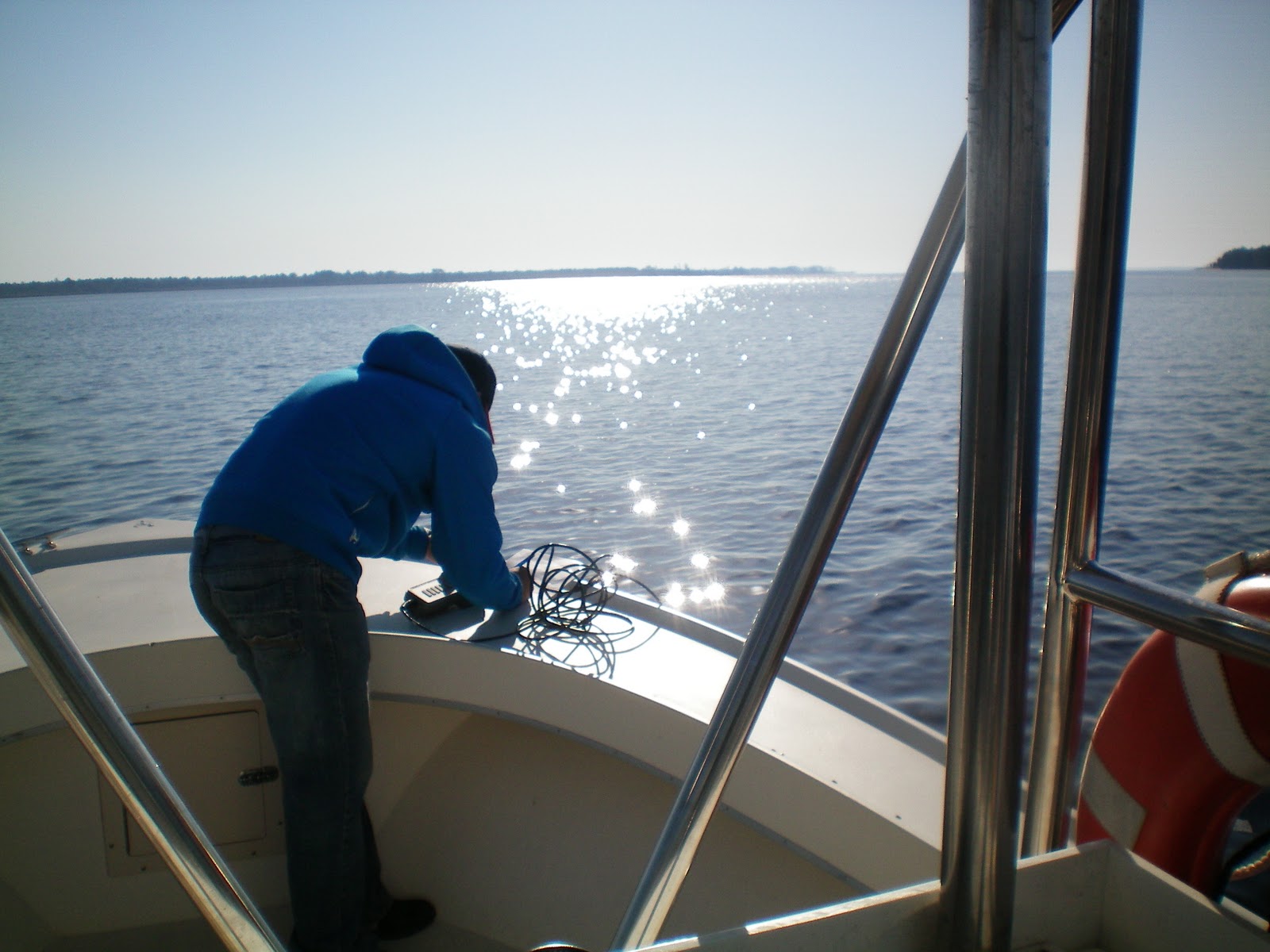
The trip started out innocently enough, we got out on the water with no problems, and it was absolutely beautiful outside, unlike previous field work endeavors.  We started collecting clams in a tidal marsh and immediately had success!  It was really cool and I was impressed that we had success so quickly.  We finished up at the first location with a decent number of clams and moved on to another location, this is where the story get interesting so it's important to pay attention to details, I'll bold the important parts.

We got to our second location, which was an island near Core Sound I think.  We anchored our boat a few yards offshore and headed around to the 
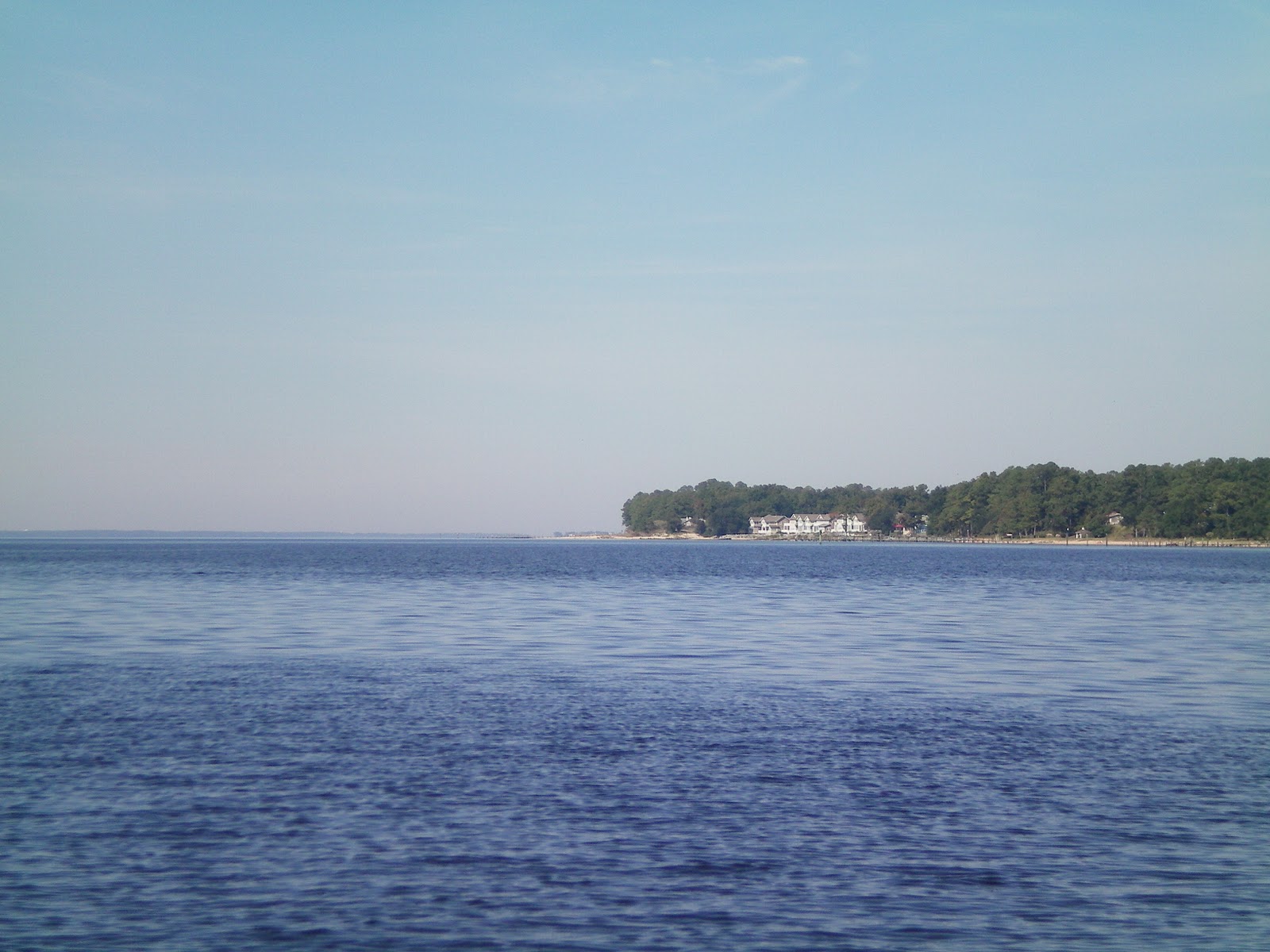
other side of the island, where there was a salt marsh to find some clams.  This marsh on this side of the island looked promising as a clam nursery area.  The location was pretty awesome, the water was shallow and clear with a nice sandy bottom.  We immediately started to find some clams in the marsh area and were completely focused on the clams.  Eventually we started collecting closer to the beach an I noticed the beach had begun to expand.  I mentioned this to my friend and he agreed, the beach was getting bigger.  Almost immediately after this conversation he said "I think I should go check on the boat", I agreed.  He made his way back to the boat and I started gathering up our gear, and then made my way back to the boat. 

I was greeted by "we might be fucked".  The boat was about three quarters on the beach with only a small amount of water lapping against the side.  The tide had gone out quite quickly leaving our boat minutes from being landlocked.  We tried to push the boat into the water with no success before deciding to try and dig it out.  Unfortunately, we had no shovels so we were forced to dig by hand.  We dug frantically for an hour periodically stopping to push the boat a little into the water.  However, the whole time we were battling against the receding tide.  We had some success digging and pushing the boat and eventually we had the majority of the boat in the water.  Unfortunately, the part of the boat that wasn't in the water was the stern (the heaviest part of the boat) giving the engine no access to the water.  This was frustrating as it rendered our digging efforts useless because there was no way for us to push the stern of the boat off the beach.


Luckily, we had camping gear, food and water with us because we had planned on camping out anyway and we had gotten comfortable with the idea of camping on this island until the tide came back in.  We sat on the beach for a while, then decided to collect more clams.  After a few minutes of collecting we noticed a boat motoring up to us.  My friend walked over to talk to the man in this boat, I followed shortly after.  The first thing this guy says to me is;

guy: "you ever dissected a badger?"
me: "huh?"
guy:  "you're shirt says Wisconsin veterinary medicine, there the badgers right?"
me:  "oh yeah, no can't say I've ever dissected a badger"

We talked to this guy for a while and he introduced himself as Davey, and said he was a commercial fishermen who mostly gill-netted for flounder.  We explained who we were and what we were doing.  Naturally he found our situation pretty funny and offered to try and pull us off the beach with his boat.  Unfortunately, this effort was futile and we remained stuck.  After chatting for a bit more this conversation took place;

Davey:  "what are you guys gonna do until the tide comes in?"
my friend:  "we'll probably just camp out here for a while"
Davey:  "ya'll can come back to my place, it's right across the river (he pointed to his house), you'll be able to see your boat from there, then I can bring you back later"
Davey:  "I mean I'm a trustworthy guy"
my friend:  "that sounds great, thank you so much"

I'm pretty sure I was standing there during this whole conversation wide eyed with my mouth agape looking particularly nervous.  Not that I didn't trust this guy, I mean he seemed like a really nice dude, but I've seen way to many horror movies that start out this way.  We got on Davey's boat and headed toward the other shore.  His house was in a really nice location overlooking the water (and we could see our boat), and he had two really awesome dogs, it was about what you would expect from a commercial fishermen.  We had some good conversations about the North Carolina gill-net regulations, amongst other fishing related topics, as well as our travels.  However, we mostly talked about sports specifically about college football, which we watched all day (Davey is a die hard Duke fan so hearing him bash UNC was pretty funny).  Occasionally, Davey would say something along the lines of "just can't believe you boys didn't realize the tide was going out", we were still pretty embarrassed about about this leaving my friend to compare the interaction to this scene from the movie Happy Gilmore.

Davey really is one of the nicest people I have ever met and he had a really good sense of humor.  The tide finally came in at round 10:30 pm that night, and we went to push the boat of the beach, and it slid gracefully into the water.  Since it was so late at night Davey offered to let us stay at his house and since we had already spent the whole day with him we said "sure".  I can't really say I slept much that night, and we woke up pretty early to leave.  We said our farewells to Davey, and graciously thanked him for saving us from being stranded on an island and his hospitality.  I'm pretty sure Davey's final farewell to us was "you boys better watch them tides" and we wholeheartedly agreed.

It was another beautiful day and our work went quickly, we even saw about 100 dolphins throughout the course of the day.  We had a ton of success finding clams on this day and finished late in the afternoon and headed back home.  This will probably be one of my more memorable field work adventures, and I can almost guarantee I will never let my boat get stranded on the beach by the tide again.   

Monday, October 11, 2010

Where are you from? Where have you been?

ResearchBlogging.org
In my opinion one of the most interesting questions asked about fish is where are you from?  Or where have you been?  Unfortunately, fish don’t carry around birth certificates that make answering these questions easy and uncomplicated…or do they?

Enter otolith microchemistry.  In a sense the elemental makeup of the core of an otolith can act as a “birth certificate” for a fish.  The idea is that the elemental composition at the core of the otolith will reflect the chemistry of the water it was born in.  If there is enough differentiation between different habitats you should be able to see clear separation between fish born in different areas.  The clearest examples of this technique have been in looking at fish from different rivers, and estuaries.

An example of this technique put to use is Thorrold et al. (1998).  In this study elemental and isotopic ratios in otoliths were used to classify juvenile weakfish to natal estuaries along the east coast of the United States.  Fish from different estuaries showed pretty clear differences in elemental and isotopic ratios, which allowed accurate classification of these fish to their natal estuaries. 
Me with weakfish
Other examples of classifying juvenile fish to their natal area include Brazner et al. (2004), which classified juvenile yellow perch to natal areas of Lake Superior and Walther et al. (2008), which classified juvenile American shad to natal rivers along the east coast.

So why is any of this important?   Well, believe it or not investigating and understanding the life history of a fish is really hard.  Traditional mark and recapture studies, which usually involve sticking a tag into a fish, releasing and then hoping to recapture it at some point are often ineffective and typically wind up relying on pretty low recapture rates.  Also, tagging young juvenile fish can be tedious and unfortunately usually has fairly high mortality.  However, if you are able to identify a reliable elemental signature for a river that is reflected in fish otoliths it acts as a “natural tag”.  Therefore, if in the future you capture an adult fish you can examine the elemental signature at the core of that otolith to determine where that fish was born.  This is what Thorold et al. (2001) did as a follow up to Thorrold et al. (1998).

This information is useful in looking at natal homing; straying rates between spawning locations, stock discrimination, movements and migrations, and by catch rates.  This technique forms the basis for my project.  I am attempting to classify juvenile river herring to natal watersheds within the Albemarle Sound NC.  While this area isn’t on the same scale as some of the studies mentioned previously, I think I should be able to find some differences in the elemental composition of fish otoliths from these waters. 

Brazner, J., Campana, S., Tanner, D., & Schram, S. (2004). Reconstructing Habitat Use and Wetland Nursery Origin of Yellow Perch from Lake Superior using Otolith Elemental Analysis Journal of Great Lakes Research, 30 (4), 492-507 DOI: 10.1016/S0380-1330(04)70365-2

Thorrold, S., Jones, C., Swart, P., & Targett, T. (1998). Accurate classification of juvenile weakfish Cynoscion regalis to estuarine nursery areas based on chemical signatures in otoliths Marine Ecology Progress Series, 173, 253-265 DOI: 10.3354/meps173253

Thorrold, S. (2001). Natal Homing in a Marine Fish Metapopulation Science, 291 (5502), 297-299 DOI: 10.1126/science.291.5502.297

Walther, B., Thorrold, S., & Olney, J. (2008). Geochemical Signatures in Otoliths Record Natal Origins of American Shad Transactions of the American Fisheries Society, 137 (1), 57-69 DOI: 10.1577/T07-029.1

Thursday, October 7, 2010

More Field Adventures!

This past Monday (October 4, 2010) a few fellow students and myself headed out to the field to collect some water samples.  This particular work was for Coley Hughes, a lab mate and fellow otolith investigator.  Coley is investigating the natal origins of Striped bass in the Albemarle Sound.  Since our study area overlaps slightly and I generally just like to be in the field I tagged along. 

The sampling areas on this particular day included the Pasquotank River, Currituck Sound, the North River and the Little River, these areas are situated in the northeastern part of the Albemarle Sound.  The day started off in the Pasquotank River;
Gorgeous autumn day!
Coley Hughes and Jeff Dobbs excited to be in the field
it was cold and windy.  Of course me being a rugged northerner decided shorts and an t-shirt were all I would really need on a day like today, I mean it's North Carolina right, how cold could it be.  To answer "pretty damn cold".  When the wind is howling and you get soaked by crashing waves it can be pretty frickin cold as I would come to find out.  To make things worse we experienced some minor boat issues that had all of us thinking our day would be cut short.  However, when those issues were sorted out things ran pretty smoothly with the exception of the rough weather.
It's always fun trying to stay balanced when boating in rough weather and I give Joey Powers mad props for getting us back to the boat launch with no problems (the video doesn't really give a good perspective on how big some of the waves actually were).

After getting off of the Pasquotank River we headed over to Currituck Sound (no pictures due to be soaking wet and not having a water proof camera).  By this time I had put on some waders, so even though I was not that much warmer I was slightly more dry.  From there it was off to the North River;
Joey Powers and Jeff Dobbs Collecting water in the North River
Things starting to calm down
Fortunately by this time the weather had started to calm down and the North River was actually quite pleasant, until...
Back to the Pasquotank!
we headed back to the downstream section of the Pasquotank River and were immediately greeted by more rough weather.  However, a funny thing happened on the way to the Little River;
Could it be?

Maybe?
It is! The sun started to come out just as we were finishing up
The sun started to come out, the wind died down, and we finished up collecting our samples on a high note. 

Having seen the entire Albemarle Sound region over the course of the summer and early fall I can definitely appreciate how beautiful the sound really is.  For the most part large areas of the shoreline remain undeveloped and are lined by conifers and cypress trees (at least I think that's what some of these trees are, what can I say I'm no dendrologist), I even saw a pod of dolphins in the early spring when I was sampling with the NCDMF.  Yet anthropogenic activity is well represented by the numerous houses and agricultural activity surrounding the watershed. 

I think the reason I am so intrigued by the sound, and estuaries in general, is because they represent an interface between the marine and terrestrial ecosystems, and increasingly humans.  This is probably why I am interested in anadromous species, because for at least one part of their life they are dependent on a habitat that is so closely linked to humans, and I have always been curious and fascinated by this interaction. 

Wednesday, October 6, 2010

CARP!

Nothing about otoliths in this blog, but still focusing on fish and an issue near and dear to my heart.  Asian carp have been in the news quite frequently for a few years now with stories ranging from their steady trek north to the Great Lakes, to people getting smacked in the head and red neck fishing derby's (do a quick search on Youtube for Asian carp, it's pretty entertaining).  It seems as though these carp have become the poster child for the damage invasive species can do. 

It appears now that scientists in the United States and Canada are teaming up to examine the impact these fish could potentially have on the Great Lakes ecosystem.  I think this is a brilliant idea and one of the reasons I love the Great Lakes, because the lakes are shared by the U.S. and Canada there is a lot of collaboration between the two countries on how to best protect the lakes (and yes I love Canada!  I love the people, the beer, the culture, curling, and of course hockey).

This issue is near and dear to myself because I spent three years working at the Lake Michigan Biological Station in Zion, Illinois after I graduated undergrad.  Part of this time was spent working on the electric barrier, located in the Chicago Sanitary and Ship Canal, designed to repel Asian carp and round goby.  We were using common carp as a surrogate to see if carp would be repelled by the barrier (they probably are, but there are other ways around).

Barrier or not, I am not completely sold on the idea of Asian carp being able to take hold in the Great Lakes because naturally, the lakes aren't the most productive systems.  The strong effort to clean the lakes has decreased eutrophication and thus productivity. Also, the introduction of zebra/quagga mussels has shifted the productivity from the water column to the benthos, leaving little in the way of food for pelagic fish like Asian carp, as well as other fish larvae.

However, I do have little doubt that if Asian carp do become established in the Great Lakes the effects would be devastating.  You could probably say bye bye to yellow perch and alewife, and without alewife there would be no salmon fishery.  Not to mention the potential hazards to boaters.  I am certainly interested in the outcome of studies dealing with these fish and hope that efforts to keep them form the Great Lakes prove effective.       

Saturday, October 2, 2010

Tour de Albemarle

After NC got something like 15 inches of rain this week we decided it might be a good idea to collect water samples from our sample locations in the tributaries of the Albemarle Sound.  The reasoning behind this is that the increased precipitation could cause drastic shifts in the elemental makeup of the water, due to increased runoff and higher flows in the river.  Many people are interested in how the elemental signature of a river changes over time, and severe weather events like heavy rain and hurricanes could be a driving force behind these changes.  This is an issue I am attempting to touch on with my research.  We have taken water sample from fixed stations in 5 different rivers from June-October hoping to examine the stability of the elemental signature. 

However, today was an extra sampling trip that was thrown together at the last minute.  After the rain finally stopped I hastily decided to drag myself into the field to scrape together some data.  Unfortunately, I could not get my hands on a boat for the weekend so I had to improvise and try and take samples from shore.  Because I was confined to land for this sampling trip I was unable to take samples from our fixed stations, although I was able to get close to a few. 

I left pretty early in the morning and was greeted by multiple road closings, due to flooding.  This made the already long trip even longer and slightly more treacherous.  I eventually made it to Plymouth NC to sample the Roanoke River and was greeted by this;

The top picture shows a submerged boardwalk, while the bottom picture shows a dock that is ominously close to being submerged.  I took my sample and headed to the Scuppernong River, then to the Alligator River and found this;

the river is almost as rough and unforgiving as the women who tried to kick me out of the marina for "trespassing on private property", sounds a bit nit-picky if you ask me.  Either way I took my sample and headed north to the Perquimans River;


there used to be docks at this boat launch and an old wooden ship if I'm not mistaken.


After the Perquimans I headed to the Chowan River and finally back to Greenville.  The whole trip was probably around 300 miles or something and it was the first time I have been to all of my sites in one day.  It was pretty interesting to see the changes these rivers had undergone due to the rain, and I am very curious to see if these changes are reflected in the elemental composition of the water.